CORINE Land Cover 2000. The Norwegian CLC2000 project
Research report
Published version
Permanent lenke
http://hdl.handle.net/11250/2469134Utgivelsesdato
2010Metadata
Vis full innførselSamlinger
Sammendrag
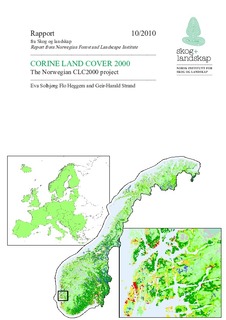
CORINE Land Cover (CLC) is a seamless European land cover vector database. The Norwegian CLC2000 was completed by the Norwegian Forest and Landscape Institute (Skog og landskap) in 2008 and was produced from existing national land cover datasets wherever available. CLC has a standardized nomenclature with 44 classes. 31 classes are represented in the Norwegian dataset. CLC is a small scale map showing built up areas, agriculture, forest and semi-natural areas, wetlands and water bodies. CLC has a minimum mapping unit of 25 ha. CLC2000 can be used for visualization of the general land cover patterns in Norway at a scale 1:250 000 or smaller. CLC2000 is representing the land cover situation close to year 20001. This report presents the Norwegian CLC2000 project and the methods and automatic generalization processes that were used in the project. CORINE Land Cover is one of four land cover maps (AR5, AR50, AR250 and CLC) published by Skog og landskap. CLC2000 was produced with support from the European Environmental Agency (EEA) who has joint ownership to the product....