| dc.contributor.author | Breidenbach, Johannes | |
| dc.contributor.author | Astrup, Rasmus Andreas | |
| dc.date.accessioned | 2017-11-01T18:44:07Z | |
| dc.date.available | 2017-11-01T18:44:07Z | |
| dc.date.created | 2017-10-18T18:37:26Z | |
| dc.date.issued | 2011 | |
| dc.identifier.isbn | 978-82-311-0140-6 | |
| dc.identifier.issn | 1891-7933 | |
| dc.identifier.uri | http://hdl.handle.net/11250/2463543 | |
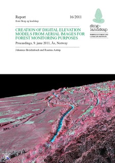
| dc.description.abstract | Vegetation height information is one of the most important variables for predicting forest attributes such as timber volume and biomass. Although airborne laser scanning (ALS) data are operationally used in forest planning inventories in Norway, a regularly repeated acquisition of ALS data for large regions has yet to be realized. Therefore, several research groups analyze the use of other data sources to retrieve vegetation height information. One very promising approach is the photogrammetric derivation of vegetation heights from overlapping digital aerial images. Aerial images are acquired over almost all European countries on a regular basis making image data readily available. The Norwegian Forest and Landscape Institute (Skog og Landskap) invited researchers and practitioners that produce and utilize photogrammetric data to share their experiences. More than 30 participants followed the invitation and contributed to a successful event with interesting presentations and discussions. We wish to thank the speakers for their contributions and hope that all participants found the seminar useful. These short proceedings of the seminar include summaries of the talks. The presentations, which provide more information, can be found at the end of this document. | nb_NO |
| dc.language.iso | eng | nb_NO |
| dc.publisher | Norsk institutt for skog og landskap | nb_NO |
| dc.relation.ispartof | Rapport fra Skog og landskap | |
| dc.relation.ispartofseries | Rapport fra Skog og landskap;16/2011 | |
| dc.subject | Digitale høydemodeller | nb_NO |
| dc.subject | Digital elevation models | nb_NO |
| dc.subject | Digitale overflatemodeller | nb_NO |
| dc.subject | Digital surface models, | nb_NO |
| dc.subject | Fotogrammetri | nb_NO |
| dc.subject | Photogrammetry | nb_NO |
| dc.subject | Landsskogtakseringen | nb_NO |
| dc.subject | National forest inventory | nb_NO |
| dc.title | Creation of digital elevation models from aerial images for forest monitoring purposes. Proceedings, 9. June 2011, Ås, Norway | nb_NO |
| dc.type | Research report | nb_NO |
| dc.description.version | publishedVersion | nb_NO |
| dc.subject.nsi | VDP::Naturressursforvaltning: 914 | nb_NO |
| dc.subject.nsi | VDP::Natural resource management: 914 | nb_NO |
| dc.source.pagenumber | 215 | nb_NO |
| dc.source.issue | 16 | nb_NO |
| dc.identifier.cristin | 1505710 | |
| cristin.ispublished | true | |
| cristin.fulltext | original | |
